Cheers,
I certainly have learned a lot about the marina basin that we’re in writing up this email. And the buildings that surround the “wet docks” There’s so much to see in Ipswich that our short time here won’t be nearly enough to do it justice. We’ll have no time at all to explore the areas that surround Ipswich which is the home of landscape artist such as John Constable and Thomas Gainsborough. More about them in a future email. In this email I’ve included several maps to help explain a bit about the area.
The weather has been lovely, though a bit chillier these past few days. Good walking weather which I did yesterday going to town 3 times. Today Randal and I walked the mile plus to Foxx’s Marina to the chandlery and then back. Good thing as I’ve become addicted to shortbread something I’d had no interest in before coming here to England. I got over Toynbee Hall Tea Cakes by eating several boxes so hopefully I’ll get over shortbread if I eat enough. Or I’ll just keep walking.
Ru
|
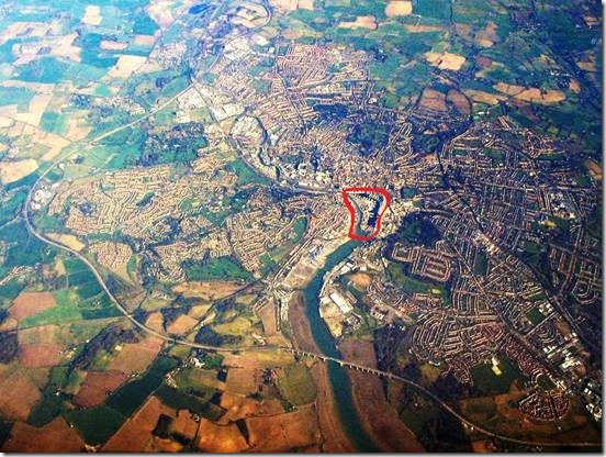
We are on “The Island” as it’s called outlined in red. http://www.waterfrontaction.co.uk/ gives a brief history of the docks area and Ipswich in general. http://www.ipswichhavenmarina.co.uk/ is the marina website |
|
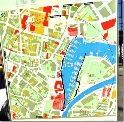
The black line is my walk from DoraMac to UCS University Campus Suffolk : the red broken line is an earlier walk to the Brewery Tap where Randal and I ate brunch thanks to the help of artist Andrew Vass. Another email for that story. |
|
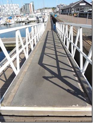
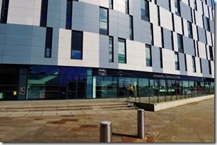
DoraMac is at the far end of the floating dock and is where I started You can see the gray and white UCS building across the river in the top left hand corner. |
|
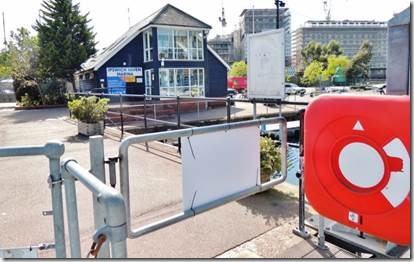
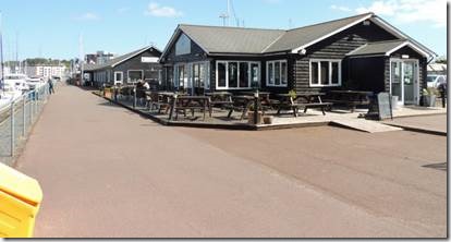
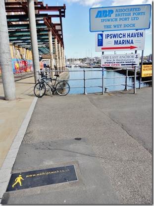
The dock exit and the Marina office building. |
|
Across from the office is The Last Anchor Restaurant, The Anchor Bakery (luckily only breads and not cakes and cookies or we would be doomed) and a small chandlery. |
|
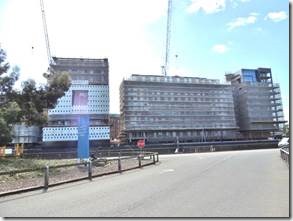
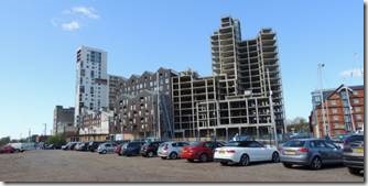
Walking out of the marina along New Cut East. The river is to the left. Lots of construction on both sides of “The Island” where the marina is located. Not very scenic, but this a developing area and very much a working dock area as well as a marina. You can see I have to go “the long way around” to get from DoraMac to the gray and white UCS building. |
|
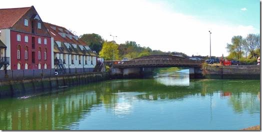
Some of the view past the construction is quite scenic. Cross the bridge and go right gets you to the railway station. Go straignt and you get to Foxx’s Marina and the larger chandlery. Instead of crossing the bridge you can go right and walk into town but we know a shorter way. |
|
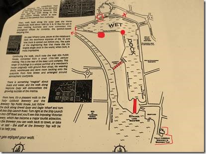
So what looks like a walkway over water actually isn’t. Randal explained to me that our marina was probably created from dredged out dirt when the Wet Dock was created which is what’s between our marina and town. The water gets very shallow and just ends. But it is higher than the water in the river because of the lock. We are the small red dot; the marina office is the bigger dot; the original lock no longer in use is the red line closest to us; the current lock was built in 1881; the tiny red line to the left of the office near the arrow is where the wet dock ends and the arrow points the way to the small scenic bridge that crosses the tidal raiver. Double box shape at the top is the Customs House and the X is the UCS building. The far end past the “new lock” is the Brewery Tap. We walk straight ahead from the tiny straight line to get to town. “Leaders of the business community got together and conceived an ambitious scheme to create a large basin and lock close to the town so penning up the water at flood tide. An Act of Parliament enabled a body of commissioners to depen the old channel and to create, bu means of ‘stupendous embankments’ a Wet Dock of 32 acres. The new channel was to be cut on the opposite side of the river to allow for the free motion of the tidal water, when Victoria had been queen for only 10 days. Digging began in June 1938. The project was a massive undertaking as well as an expensive one. Investments worth £25,000 were made over to the Dock Commission with permission to borrow a further £60,000. This was not enough, and in 1843 the Commission had to apply for another loan of £20,000 plus a levy of an extra 6 pence per ton on all imported coal. The foundation stone was laid in June 1839 and, early in 1842, when the lock gates were closed for the first time at high water, Ipswich harbour became the largest Wet Dock in the kingdom.” The History of Ipswich by Carol Twinch c. 2008 |
|
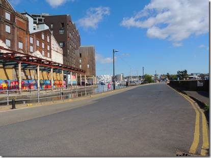
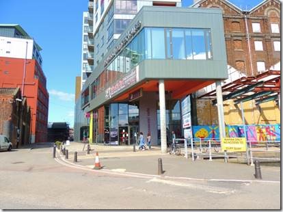
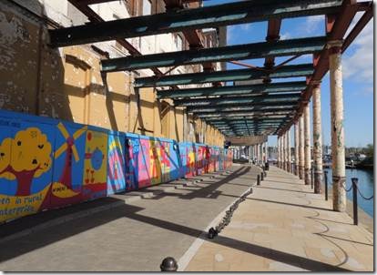
The Mill on the left and the Never Ending Mural on the right. http://lifeatthemill.co.uk/ to the left is the tallest building in Ipswich and it’s down this road we leave the marina area for town. “England has a new mode of architectural expression. It’s called Cabe-ism (by me, at least) and has taken ten years to perfect. It draws upon many sources: Gordon Cullen’s Townscape philosophies, Ian Sinclair’s psychogeographic musings, public-private (usually develop-led) ideas about brownfield regeneration and transparent decision-making inspired by New Labour. Throw in a bit of old-fashioned modernism, concern around climate change and some mixed-messages about ‘iconic’ design. Finally, sprinke liberally with branding concepts culled from 80s-style advertising culture, and what you have is Cabe-ism. If you want to see the kind of buildings this ‘movement’ has fashioned, go to Ipswich and visit Cranfield Mill on the Suffolk town’s waterfront.* Designed by John Lyall Architects for the East of England Development Agency and Wharfside Developments, this is Cabe-ism’s posterboy, a mixed use scheme of 382 dwellings, a dance venue, a multi-storey car park, with a public courtyard, retail and leisure built in. It’s not hard to find. It’s focus is totemic: a 23 storey tower, the tallest in East Anglia, rendered a very bright white, and visible from miles around.” http://www.architectsjournal..co.uk/ “Work is under way on a mile-long mural on the Ipswich Waterfront. Titled the Never Ending Mural, the artwork is based on drawings by young people in the county and has been curated by Ipswich Art School.” http://www..bbc.co.uk/news/uk-england-suffolk-13761773 Ipswich-based artist John D Edwards, in conjunction with Ipswich Borough Council and the community-at-large, hopes to provide a way of linking the town’s cultural activities with a Never Ending Mural which will visually link the various artistic districts of the town…… John was also taken aback when a five year old girl told him that she loved money. “I thought: ‘Here we go. The power of money rearing it’s ugly head.’ I was polite and said: ‘Oh yes, what do you like to spend it on?’ She looked at me blankly and said rather crossly: ‘No Monet, the man who painted the Water Lilies.’ Isn’t that glorious? It just goes to show that you shouldn’t pre-judge youngsters. Interestingly her mother didn’t know that she knew about Monet, so it was something else that this project has helped shed light on. The Never Ending Mural will be started next month on the Ipswich Waterfront before then moving onto the Ipswich underpasses which span Civic Drive before going onto Crown Street car park and the area around Ipswich Museum, Ipswich Art School Gallery and the New Wolsey Studio.” http://johndedwards.co.uk/?page_id=134 about John Edwards who spearheaded the mural. |
|
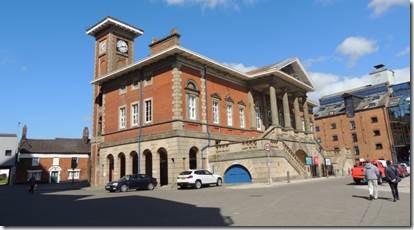
The “Old Customs House” that is still in use today. |
|
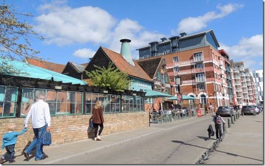
The Bistro, Isaac Lord Pub/Restaurant and the Salthouse Harbour Hotel : we hope to visit Isaacs before we leave. |
|
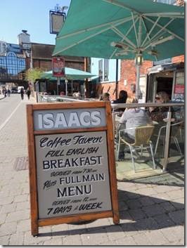
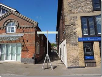
Advert board for Isaacs and the alley which leads to Fore Street and to the Jewish Cemetery; and also to the John Russell Gallery a whole story in itself! |
|
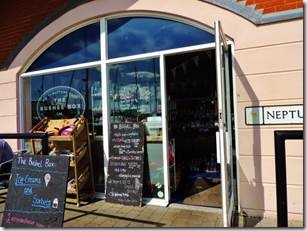
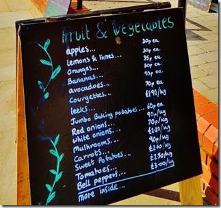
The Bushell Box which is cute but we shop in Sainsbury in town or the outdoor market Tuesday to Saturday in Ipswich center. |
|
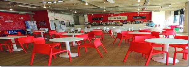
University Suffolk Campus Waterfront location with its Waterfront Gallery and Theata Café |
|
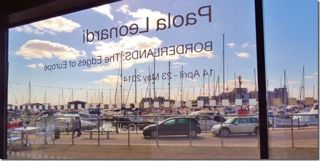
Borderlands : The Edges of Europe Photographs by Paola Leonardi “Borderlands: The Edges of Europe” is a collection of analogue photographs representing the people and places along the borders of the European Union, developed with the purpose of creating an archive of images narrating life at the edges of Europe. Since 2011 Leonardi has undertaken extensive walks along the land borders of the European Union. Proceeding slowly on foot and following methodically the boundaries traced on maps, she has built up a distinctive experience of the European frontier that includes unplanned encounters with its inhabitants. This series focuses on the connection between people and territory and the significance of trans-national and transcultural identities, exploring the relevance of European identity and its relationship with concepts of home and belonging, memory and territory and how these have been shaped by events. This project concentrates on land borders, and the concept of geographical Europe is juxtaposed to that of political Europe/European Union. For example, it does not include the borders of Switzerland, which is not EU however does not have restrictions towards EU citizens. PAOLA LEONARDI – BIOGRAPHy Paola Leonardi (born Italy 1980) is a London based photographer and a lecturer in Photography at University Campus Suffolk. Since completing the MA Image and Communication at Goldsmiths College in 2006, Paola has worked both commercially as well as developing personal projects. Her work has been previously sponsored by the Arts Council England and she has exhibited in the UK, Italy, Armenia and the US. (I wish I’d been more impressed by the photos but I wasn’t. Her photos of N Cyprus said nothing to me and I’ve been there. But she seems to be focusing on the borderlines and we weren’t. However her fashion photography I do like. http://leonardiphoto.com/portfolio/commercial/ |
|
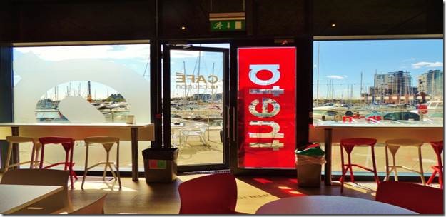
Looking out from Theta Cafe |
|
Artistic license on this shot |
|
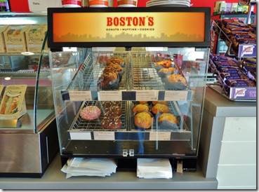
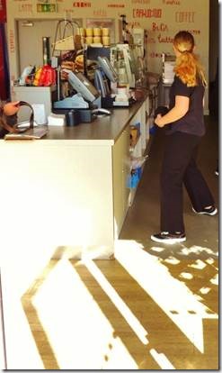
Boston’s Donuts and the very welcoming Xanita who assured me that Boston Donuts were from Boston but according to their website they aren’t exactly from Boston. These seem to be made by the Brake Company in the UK. I did write to the company and asked what was special about the ingredients that related to Boston to explain the name. We’ll see if they answer. I bought a Chocolate and Strawberry which were about the last 2 left. I gobbled my strawberry one down covered with whipped cream! I did have a lovely chat with Xanita who’s friendly smile I’ll get another day. I just snuck this one on my way out. |
|
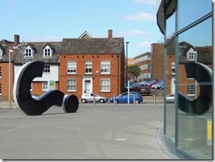
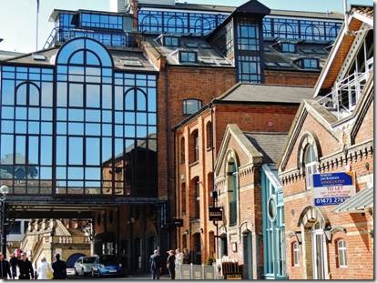
A different perspective on the walk back seeing the dock reflected in the windows of Waterfront House. While writing this email it took forever to find out what the glass fronted building was until Randal used the binoculars to read Ashton KCJ written on the top floor and then I could find the building’s name. Waterfront House Wherry Quay, Ipswich, Suffolk IP4 1AS – England, UK A former barley warehouse, Waterfront House was one of the first derelict dockside buildings to be given a new lease of life. Built around 1880, some 50 years after the docks first opened in 1842, it was converted into state-of-the-art offices one hundred years later. It now has seven floors of offices, its crowning glory, a glass boardroom on the top floor with spectacular views down the River Orwell. http://www.ukattraction.com/east-of-england/waterfront-house.htm |
|
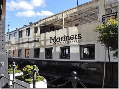
Mariners Restaurant floating restaurant moored permanently here in Ipswich. “Mariners: Brief History of the Boat Built by Acieries de Bruges, Bruges as gunboat ss Argus Launched 1899, commissioned 1900 for the department of the Belgium State May 1940 Requisitioned by "Corps de Marine" (Belgian Navy)- sunk, raised and repaired by the Germans 11 December 1945 Returns to owners in Antwerp and back in service as FLANDRIA VII 1952/53 Fitted out as a Red Cross hospital ship and renamed FLORENCE NIGHTINGALE (Dutch Flag) In the early Seventies Fitted out as a party boat and operated as such for 18 years November 1990 Handed over to Contship Ltd and subsequently crossed to Harwich and moored in Ipswich Docks. Transformed into an Italian restaurant named Il Punto. March 1994 Taken over by Mr Regis Crepy (owner of the Great House, Lavenham and Maison Bleue, Bury St Edmunds) and changed to a French Brasserie. Today Mariners (Formerly Il Punto) is an award winning restaurant, open Tuesday to Saturday, serving French food in a fantastic atmosphere, with Al Fresco eating on our patio deck in fine weather. The boat can be booked for special parties” http://www.marinersipswich.co.uk/history_of_mariners_boat.htm |
|
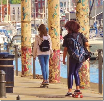
Two young women skateboarding… I was impressed that they were women but too bad they’ve no protective gear. |
|
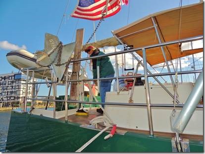
Randal spent the whole time swabbing the decks@ |
|
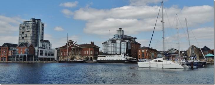
Looking back from our side of the basin. The Mill is the tall building on the left, the Customs House in the middle and the Waterfront House on the right with the Mariners in front and then Isaac Lords further to the right behind the sailboats. http://www.stacey.peak-media.co.uk/Ipswich/Ipswich-Docks/Ipswich-Docks.htm interesting photos of the docks recent development. Several of the buildings were damaged from bombing during the war and then others had just become derelict. |

